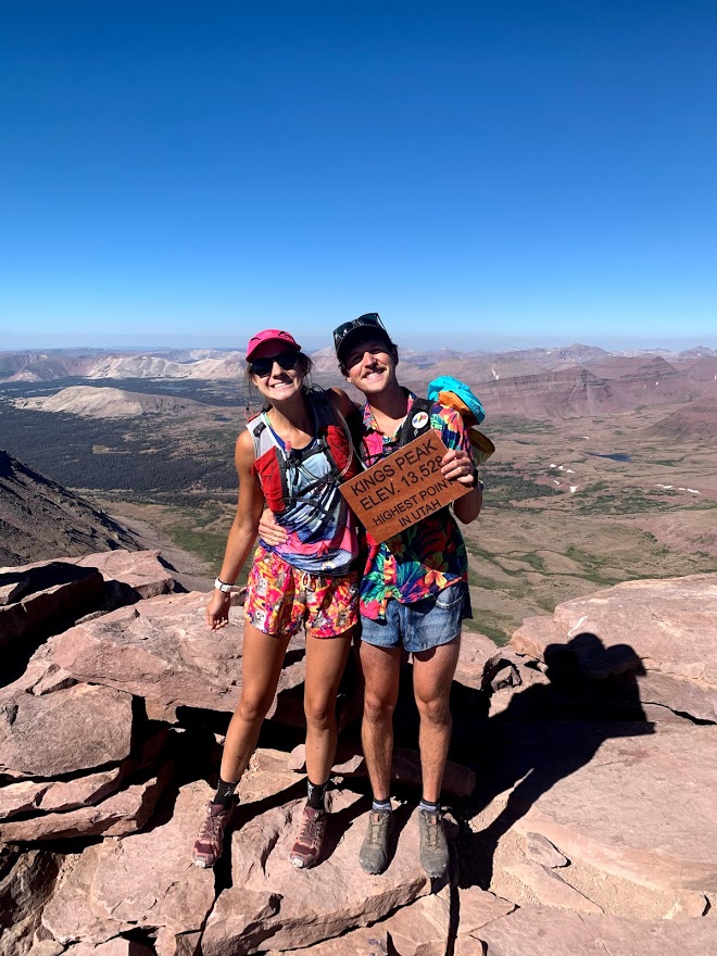
Okay so we set out to climb Utah’s highest peak, King’s Peak, and on the drive up while trying to figure out the best way to get up the mountain we discovered a linkup called the Utah Triple Crown. This was a linkup of Utah’s THREE highest peaks. Why not make a hard day harder, we decided to shift plans and go for the triple crown babyyy.

BUT FIRST, WHAT WE LEARNED BOB!!
If we were to do it again! There has got to be a better way folks and here it is. Hit Gilbert first, get that minefield of boulders out of the way early. Head towards Gunsight peak instead of the chute that everyone climbs up. Skirt around gunsight without tagging the peak and drop onto gunsight pass. This section will be exposed, but it definitely goes if you are careful. From gunsight pass head to Kings Peak but take a more direct approach. Following the ‘established’ trail adds a lot of extra distance. Hit Kings and then South Kings as usual. Head down the scree chute near Anderson Pass, intersect the main trail and you are home free. This should save you hours, but try at your own risk. This way hasn’t been attempted as far as we know. Actually scratch that, we really have no clue!!.
Okay as we were. Davy Crockett, an accomplished ultra runner out of Salt Lake puts it nicely:
Here is what makes this adventure so difficult:
– All of it is above 9,400 feet altitude
– There is 14 miles of “bowling ball” rock trail
– You will be running about 7 hours above 12,000 feet
– There is 11 miles without a defined trail
– Eight of those miles involve boulder hopping
– About 9,500 feet of climbing
We drove out to Henry Fork Trailhead the night before and found a sweet camping spot with a table and firepit. There were lots of cars around so we were pretty surprised to actually find a real spot. We made a hearty scramble (beans and saltines!) and tried to go to bed early, for we had to wake up at 4:20 the next morning! #blazeit
Okay so the three highest peaks are Kings Peak (13,528′), South Kings Peak (13,512), and Gilbert Peak (13,442′). The standard route climbs them in that order. Although in hindsight I would switch things up (more on that later). We opted to attack the standard way so we could bag King’s Peak first (our original objective) and if we were hating life by that point we could call it a day and still be pretty happy about it.
We woke up at 4:20, slammed some Bangs, and headed off in the dark. We knew this was going to be a long day HA! Almost immediately the trail got pretty dang rocky and bouldery and slowed us down to a powerhike – an omen for the rest of the journey. We popped out of the treeline a little after sunrise and were treated to some smooth flat trails for a sec. These are the moments we life 4 #blessup

We made pretty good time up gunsight pass. Keeks grinding with gunsight pass and gunsight peak in the background.

Once we got over gunsight pass, we started catching up to all the hikers that were tagging King’s Peak from Dollar Lake. There were loads of em’! We kept telling them they must’ve gotten a crazy early start. It was a pretty bad joke and no one laughed at it.
Getting to the top of King’s Peak feeling good! Guess we got more in store!
Okay so the real takeaway to this zone is that it is LITTERED with big loose boulders. Progress is so much slower than you would expect. Lots of balancing, giant rocks shifting under your feet, and generally unpleasant terrain to cover. South King’s Peak was a relatively short detour, but pretty rocky. Here is Keeks heading up South King’s.

And after tagging S King’s, heading back towards King’s Peak. Not cruiser at all!

Coming down King’s peak towards the chute near Anderson Pass.

Okay this was one of the more bizarre things that we happened across. Hundreds of sheep up at 12,000′! Anyone know what they are doing here??

We headed towards Anderson pass and tried our best to intersect the main trail for awhile before heading up a chute to get on the ridge for Gilbert. Here check out the map on Strava, you gotta see it to believe it
https://www.strava.com/activities/3919275800
So we were both not feeling too hot heading up Gilbert. It felt like an endless ridge of false summits and boulders. Seriously cannot understate how many miles of loose tumbly boulders this trip was. We eventually made it and had a little gummy celebration!


Coming down was just as pleasant!

Eventually things opened up and we were able to follow a less-rocky ridge down to dollar lake.


We were able to follow our GPS back to the main trail and run the last 7 miles of trail back to the car. We don’t remember much from this section, maybe blacked out, other than a lady with a horse getting really mad at us for some weird reason. We cruised back to the trailhead and made some Ramen to fuel our drive back home. We were mad we didn’t celebrate harder, but we must have been too tired.


